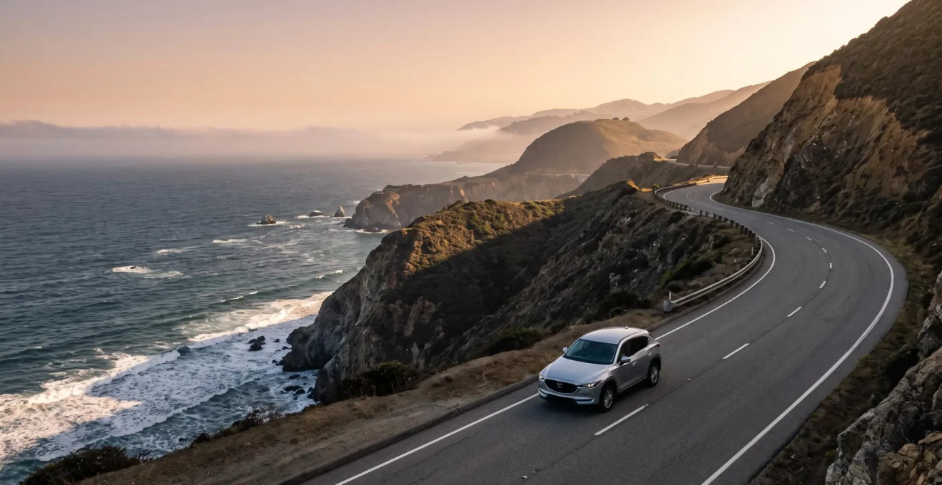
In summary:
- Driving from North to South (e.g., San Francisco to LA) is strategically superior for constant, unobstructed ocean views and safer pull-offs.
- Big Sur’s frequent landslides require a flexible plan; always have a pre-mapped inland detour like Highway 101 ready.
- For a multi-day trip, an SUV’s comfort and luggage space almost always outweigh a convertible’s classic vibe, especially on winding roads.
- Popular stops like Carmel-by-the-Sea must be booked 6+ months in advance to avoid disappointment and inflated prices.
- Expand your trip north to Oregon’s Pacific Coast Highway for dramatic scenery that rivals Big Sur but with fewer crowds and lower costs.
The dream of driving California’s Highway 1 is a powerful one, especially for UK travellers picturing themselves cruising along the Pacific in a classic convertible. It’s an iconic journey, filled with world-famous landmarks from the Golden Gate Bridge to the dramatic cliffs of Big Sur. But the reality of this epic road trip often gets lost in the clichés. Most guides offer a simple checklist of stops, leaving you unprepared for the logistical challenges that can quickly lead to exhaustion and disappointment. The sheer scale of the drive, the unpredictable road conditions, and the intense demand for accommodation are rarely addressed with the detail they deserve.
What if the key to an unforgettable trip wasn’t just about *what* you see, but *how* you plan for it? This is where logistical intelligence comes in. Burnout on a trip of this scale is a real risk, born from long driving days, stressful detours, and the frustration of fully-booked towns. This guide moves beyond the typical itinerary to focus on the strategic decisions that will truly define your experience. We’re not just listing sights; we’re giving you the ‘why’ behind the critical choices you’ll make, from your direction of travel to the type of vehicle you rent.
By focusing on strategic pacing and burnout-proofing your plan, you can transform a potentially stressful drive into the seamless, awe-inspiring adventure you’ve always imagined. We’ll tackle the most common mistakes, from underestimating Big Sur’s volatility to missing the perfect light at Bixby Bridge. We’ll even look beyond California to show you why the Oregon coast might just be the hidden gem your multi-state journey needs. This is your insider’s guide to mastering the road, not just driving it.
This article breaks down the essential strategies for crafting your perfect Pacific Coast road trip. Follow along as we cover the key decisions that will ensure your journey is as spectacular in reality as it is in your imagination.
Summary: Crafting Your Perfect Pacific Coast Highway Journey
- Why driving North to South offers superior ocean views?
- How to bypass the frequent landslides in Big Sur without losing 5 hours?
- Convertible or SUV: which vehicle to rent for comfort on winding roads?
- The mistake of not booking Carmel-by-the-Sea 6 months in advance
- When to stop at Bixby Bridge for the perfect light without the fog?
- How to rent a dune buggy to explore the Oregon Dunes safely?
- HOV Lanes: why driving alone in the left lane can cost you $400?
- Pacific Coast Highway: Why the Oregon Coast Rivals California’s Big Sur?
Why driving North to South offers superior ocean views?
Alright, let’s start with the single most important strategic decision you’ll make: your direction of travel. While you can technically drive Highway 1 either way, driving from North to South (for example, starting in San Francisco and heading towards Los Angeles) offers a demonstrably superior experience. It’s not just a preference; it’s a tactical advantage that enhances both your views and your safety. Think about it: in the US, you drive on the right side of the road. This means a southbound journey places your car in the ocean-side lane for the entire duration of the coastal route.
This “directional advantage” has two massive benefits. First, your passenger gets an uninterrupted, front-row seat to the Pacific Ocean, without the roof of the car or the other lane of traffic obstructing their view. It turns the drive from a series of glimpses into a continuous panoramic film. Second, and more practically, it makes stopping at the countless scenic overlooks (known as ‘vista points’) incredibly easy and safe. You simply signal and pull off to the right. When driving northbound, every stop requires you to wait for a break in oncoming traffic to turn left across the highway, a process that is both stressful and time-consuming.
Over the course of a multi-day trip, these small conveniences add up, reducing driver fatigue and maximizing your “experience-per-mile.” You’ll be more inclined to make spontaneous stops for that perfect photo opportunity because it’s effortless. Choosing to drive southbound isn’t just a tip; it’s the foundational choice for a low-stress, high-reward journey. It sets the tone for your entire adventure, ensuring the star of the show—the magnificent coastline—is always right beside you, never an arm’s length away.
How to bypass the frequent landslides in Big Sur without losing 5 hours?
The dramatic beauty of Big Sur comes from its geology: mountains plunging directly into the sea. Unfortunately, this same geology makes it one of the most volatile stretches of coastline in the United States. Road closures due to landslides are not a rare inconvenience; they are a regular, expected occurrence. The area has more than 1,500 mapped landslides, making it a hotspot for disruptions. Ignoring this reality is the fastest way to turn your dream trip into a logistical nightmare, forcing you into a frustrating five-hour detour if you’re unprepared.
The key is not to hope a slide won’t happen, but to plan as if it will. The scale of these events can be immense; after major winter storms, Caltrans (the California Department of Transportation) has removed debris equivalent to hundreds of dump trucks from a single slide to reopen the highway. Your number one piece of logistical intelligence is to have a pre-planned Plan B. Before you even leave your hotel in the morning, check the Caltrans “QuickMap” app or website for any closures on Highway 1 through Big Sur. If there’s a closure, don’t try to “drive up to the closure to see.” You will lose hours.
Instead, immediately pivot to your alternate route: Highway 101. This major inland highway runs parallel to Highway 1 and is your main bypass. For example, if you’re in Monterey and the road is closed south of Big Sur, you’ll take Highway 68 East to Salinas, where you’ll join Highway 101 South. You can follow this down to towns like Paso Robles or San Luis Obispo and then cut back to the coast via Highway 46 West. This is still a significant detour, but by having the route mapped out in advance, you accept it as part of the adventure rather than a day-ruining surprise. This proactive mindset is crucial for burnout-proofing your trip.
Convertible or SUV: which vehicle to rent for comfort on winding roads?
The fantasy of this road trip is almost always set in a convertible, wind in your hair as you hug the coastal curves. It’s a fantastic image, but for a multi-day journey, it’s a choice that pits style against practicality. For most UK travellers, especially those planning a trip longer than a weekend, an SUV is the smarter, more comfortable, and ultimately more enjoyable option. The decision comes down to three factors: luggage space, long-haul comfort, and handling the varied conditions.
First and foremost is luggage. A convertible’s trunk space is notoriously small, often barely fitting one large suitcase, let alone two. This isn’t a minor issue; it means your backseat will likely become a storage unit, making the car feel cramped and leaving your belongings visible when parked. An SUV, by contrast, offers ample, secure, and out-of-sight storage for all your gear. This simple factor dramatically reduces daily stress.
This illustration highlights the critical trade-off. The tight, limited space in a convertible’s trunk is a stark contrast to the generous capacity of an SUV, a practical consideration that directly impacts your comfort and security over a long journey.
Second is comfort. Highway 1 is not a straight, smooth motorway. It features long stretches of tight, winding roads and significant changes in elevation. An SUV’s higher driving position provides better visibility over guardrails and around corners, reducing driver strain. The seats are typically designed for longer-distance comfort, which you’ll appreciate by day three. Finally, while a convertible is fun on a perfect sunny day, the coastal weather is fickle. You’ll encounter fog, wind, and cooler temperatures, especially outside of peak summer, meaning the top will be up more than you think. An SUV provides a quiet, climate-controlled cabin that serves as a welcome refuge after a windswept stop at a viewpoint.
The mistake of not booking Carmel-by-the-Sea 6 months in advance
Carmel-by-the-Sea is a fairytale village of enchanting cottages, hidden courtyards, and a stunning white-sand beach. It’s a mandatory overnight stop for many on the Highway 1 route, and that is precisely the problem. The single biggest mistake travellers make is underestimating just how high the demand is for this small town’s limited number of hotel rooms. Thinking you can find a reasonably priced place to stay a few weeks—or even a few months—in advance is a recipe for disaster. For popular times of the year, you must adopt a mindset of booking at least six months out.
Unlike larger cities, Carmel has fiercely protected its small-town character. There are no large chain hotels, only smaller, independent inns and boutique hotels. This limited inventory collides with immense global demand, creating a classic supply-and-demand squeeze. If you wait, you will be faced with two scenarios: either the town is completely sold out, or the few remaining rooms are priced at astronomical rates that can shatter your budget. This forces you into a stressful, last-minute search for accommodation in a less desirable location, like Monterey or further inland, completely disrupting your strategic pacing.
Booking your Carmel stay the moment you book your flights is a critical piece of logistical intelligence. It’s not just about securing a room; it’s about securing your peace of mind and protecting your itinerary. Having your anchor points—like your nights in San Francisco, Carmel, and Santa Barbara—locked in early allows you the freedom to be more spontaneous with your daytime activities. Think of it as setting the strong foundation upon which the rest of your flexible, burnout-proof road trip is built. Don’t let a lack of planning in this key location derail your perfect coastal drive.
When to stop at Bixby Bridge for the perfect light without the fog?
Bixby Creek Bridge is more than just a bridge; it’s the defining icon of Highway 1. Getting that perfect, postcard-worthy shot is a top priority for many, but it’s not as simple as just pulling over. The two variables you’re battling are crowds and the infamous coastal marine layer, or fog. The key to success is timing. To get that magical shot with warm, golden light and a minimal chance of fog, you need to aim for a very specific window: late afternoon, roughly one to two hours before sunset.
During the morning and midday, two issues arise. First, the marine layer is often thickest in the morning, completely obscuring the bridge and the coastline. While it can “burn off,” it’s unpredictable. Second, if the sun is out, it will be high and directly overhead, creating harsh, flat light that washes out the texture of the cliffs and the elegant lines of the bridge. This leads to flat, uninspiring photos. Furthermore, midday is when tour buses and the majority of day-trippers arrive, making the primary viewpoint (Castle Rock Viewpoint, just north of the bridge) incredibly crowded and difficult to park at.
By arriving in the late afternoon, you benefit from the “golden hour.” The sun is lower in the sky, casting a warm, angled light that illuminates the western-facing arches of the bridge beautifully. This light brings out the dramatic shadows and rich colors of the landscape. As a bonus, the fog often recedes from the coast in the afternoon, leaving stunning wisps in the canyons below the bridge, adding a layer of atmosphere to your photos.
This strategic timing allows you to capture the bridge in its best possible light, transforming a simple snapshot into a breathtaking photograph. The crowds also tend to thin out as the day-trippers head back, giving you more space and time to compose the perfect shot. It’s a simple shift in your schedule that delivers a massively outsized reward.
How to rent a dune buggy to explore the Oregon Dunes safely?
If you’re extending your road trip north, the Oregon Dunes National Recreation Area offers an experience you simply can’t get in California: the thrill of driving a dune buggy across a vast Sahara-like landscape of sand that meets the sea. It’s an unforgettable adventure, but safety is paramount. Reputable rental companies in towns like Florence or North Bend have a highly structured process to ensure you have fun without taking unnecessary risks. Knowing what to expect makes the process smooth and safe.
First, understand that you won’t just be handed the keys. Professional operators have a mandatory safety orientation. This typically includes watching a short safety video and having a staff member walk you through a 3D map of the dunes, pointing out marked trails, boundaries, and potential hazards. Some operators even equip their vehicles with touchpad GPS maps that can guide you back if you get disoriented. This isn’t a suggestion; it’s a requirement. Drivers must be at least 18 and hold a valid driving license.
Second, all essential safety gear is provided and non-negotiable. You will be required to wear a helmet and goggles, which are included in your rental fee. This protects you from both impacts and the sting of wind-blown sand. For first-timers or families, consider the “Follow Me Tour” option. Here, you drive your own rented buggy but follow an experienced guide on a pre-set scenic route. It’s the perfect way to build confidence and see the best parts of the dunes without the stress of navigation. For those more confident, a “free roam” rental gives you the freedom to explore the marked areas at your own pace.
Your Pre-Ride Safety Checklist: Oregon Dunes
- Attend the mandatory safety orientation: Pay close attention to the safety video and the staff’s review of the dune map to understand the terrain and boundaries.
- Confirm your gear: Ensure you receive a helmet and goggles that fit properly. Wearing both is required at all times during your ride.
- Verify driver eligibility: Make sure every potential driver in your group is at least 18 years old and carries their valid driver’s license with them.
- Assess your confidence level: Honestly evaluate your off-road experience. If you’re a beginner, opt for a guided “Follow Me Tour” for a safer, stress-free introduction.
- Understand your vehicle’s operation: Before setting off, have the staff show you the controls of your specific UTV or buggy, including how to use the GPS if equipped.
HOV Lanes: why driving alone in the left lane can cost you $400?
As you navigate the multi-lane freeways around major US cities like San Francisco and Los Angeles, you’ll encounter a feature that can be confusing and costly for UK drivers: the High-Occupancy Vehicle (HOV) lane. This is the innermost (leftmost) lane, marked with a distinctive white diamond symbol on the asphalt. It’s also known as the carpool lane, and its purpose is to reward people for sharing rides by offering a faster, less congested route. The rule is simple: you can only use this lane if you have a minimum number of people in your car, usually two or three (indicated on roadside signs).
Driving in this lane alone, even for a short distance, is a violation that can result in a hefty fine—often starting around $400 or more in California. Highway patrol officers actively monitor these lanes, and a solo driver in an HOV lane is an easy target. The lane is typically separated by solid white or double yellow lines, meaning you can only enter and exit at designated points where the lines are broken. Crossing the solid lines is a separate violation in itself.
Some drivers get creative in their attempts to cheat the system, using mannequins or other props to simulate a passenger. The California Highway Patrol (CHP) has a sense of humor about it but is not lenient, as one officer noted after pulling over a driver with a costumed dummy. They shared the photo online with a witty warning:
We like Marvel characters too but don’t pretend like you’re not trying to cheat the system.
– Contra Costa CHP, CBS News San Francisco
For UK visitors, the takeaway is clear: unless you meet the passenger requirement displayed on the signs, stay out of the diamond lane. It’s a simple piece of local knowledge that will save you from a stressful and expensive encounter with law enforcement, keeping your road trip budget intact for more enjoyable pursuits.
Key Takeaways
- Strategic Pacing: The key to avoiding burnout is not a rigid itinerary, but building in flexibility, booking key stops months in advance, and setting realistic daily driving goals.
- Embrace the Detour: On a route as volatile as Highway 1, your ‘Plan B’ is as important as your ‘Plan A’. Always have an inland bypass like Highway 101 ready to go.
- Look Beyond California: A true Pacific Coast road trip is incomplete without Oregon. Its dramatic, accessible, and less-crowded coastline offers a perfect contrast to the intensity of Big Sur.
Pacific Coast Highway: Why the Oregon Coast Rivals California’s Big Sur?
For many, the Pacific Coast Highway is synonymous with California’s Big Sur. But by limiting your journey to one state, you miss out on a coastline that is arguably just as spectacular, more accessible, and significantly lighter on your wallet: the Oregon Coast. While Big Sur is defined by its high, often inaccessible cliffs and a single, precarious road, Oregon offers a different kind of coastal magic. Here, the highway runs closer to the sea, weaving through a series of charming towns, past dramatic sea stacks, and alongside vast, walkable beaches.
The experience is fundamentally different. In Oregon, you’re not just viewing the coast from above; you’re immersed in it. You can easily pull over and walk for miles on beaches like Cannon Beach, dominated by the iconic Haystack Rock, or explore the tide pools at Ecola State Park. The landscape is dotted with picturesque lighthouses and offers unique adventures like the dune buggy rides near Florence. This accessibility creates a more intimate and varied coastal experience compared to the often-singular focus of the Big Sur drive.
Perhaps the most compelling argument for Oregon is its value. The crowds are thinner, and the cost of accommodation is generally much more reasonable. A pre-trip comparison of lodging costs will reveal a stark difference, allowing your travel budget to stretch further. This data on hotel pricing in a prime Oregon location like Cannon Beach illustrates the point clearly.
As this affordability snapshot of Cannon Beach shows, even a popular destination in Oregon offers a wider range of pricing, making it a more budget-friendly alternative to the premium costs often found in Carmel or Big Sur.
| Metric | Cannon Beach, Oregon |
|---|---|
| Average hotel price (all season) | $395/night |
| High season average | $737/night |
| Average budget hotel price | $191/night |
| Average luxury hotel price | $829/night |
For a UK traveller planning a multi-state road trip, including the Oregon coast isn’t just about adding more miles; it’s about adding a different texture to your adventure. It provides a refreshing change of pace from the intensity of California and proves that the title of “most beautiful coastline” is very much up for debate.
Now, it’s time to stop dreaming and start planning. Use these strategies to build your own burnout-proof Highway 1 adventure and hit the road with confidence.